Flush Bracket near Middletown
Introduction
The photograph on this page of Flush Bracket near Middletown by Rossographer as part of the Geograph project.
The Geograph project started in 2005 with the aim of publishing, organising and preserving representative images for every square kilometre of Great Britain, Ireland and the Isle of Man.

There are currently over 7.5m images from over 14,400 individuals and you can help contribute to the project by visiting https://www.geograph.org.uk
Flush Bracket near Middletown
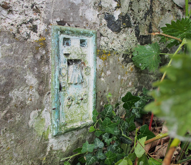
Image: © Rossographer Taken: 28 May 2017
Flush bracket bench mark on the north gable wall of a ruined cottage on the corner of the Derryhaw and A3 Armagh-Monaghan roads Image (it was well hidden behind a huge mound of nettles and brambles which had to be beaten down first). The number on the bracket is OSBM 3192. The mark has been levelled to 69.64 metres above MSL.
Images are licensed for reuse under creativecommons.org/licenses/by-sa/2.0
Image Location
Latitude
54.296125
Longitude
-6.788018