Grannie's Steppies near Pitmedden
Introduction
The photograph on this page of Grannie's Steppies near Pitmedden by Ken Ross as part of the Geograph project.
The Geograph project started in 2005 with the aim of publishing, organising and preserving representative images for every square kilometre of Great Britain, Ireland and the Isle of Man.

There are currently over 7.5m images from over 14,400 individuals and you can help contribute to the project by visiting https://www.geograph.org.uk
Grannie's Steppies near Pitmedden
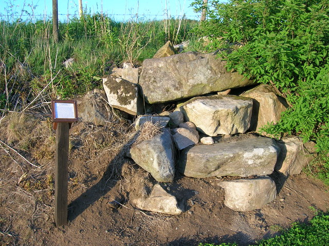
Image: © Ken Ross Taken: 23 May 2007
At the SouthEast entrance to Pitmedden on the B999 lies the, locally known, "Grannie's Steppies" a small pile of stones. It's thought that they may have once formed part of a stone circle that was situated on the fields behind, a favourable south/south west facing slope. A 1826 map shows a "burial mount" on the slope, semi-confirming the idea. Other claim that they may have formed stepping stones over the local burn.
Images are licensed for reuse under creativecommons.org/licenses/by-sa/2.0
Image Location


Leaflet Map data © OpenStreetMap
Latitude
57.335296
Longitude
-2.174895