Lynton & Barnstaple Railway Bridge 6
Introduction
The photograph on this page of Lynton & Barnstaple Railway Bridge 6 by Barrie Cann as part of the Geograph project.
The Geograph project started in 2005 with the aim of publishing, organising and preserving representative images for every square kilometre of Great Britain, Ireland and the Isle of Man.

There are currently over 7.5m images from over 14,400 individuals and you can help contribute to the project by visiting https://www.geograph.org.uk
Lynton & Barnstaple Railway Bridge 6
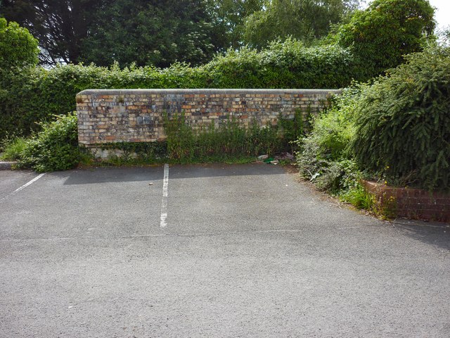
Image: © Barrie Cann Taken: 28 May 2017
All that remains of Bridge 6 "Derby Lane Bridge" which went over the Lynton & Barnstaple Railway - this is the west face, with the bridge almost entirely filled in by a parking area for the surrounding houses. The track ran from the bottom of the picture, and under the brick parapet wall, approximately eight feet below the present tarmac level The Lynton & Barnstaple Railway was a 19 mile long narrow gauge railway, which ran across the stunning Exmoor landscape, from 1898, until its closure in 1935. In 2004, after many years of hard work and negotiation, a small section was re-opened. One of the world’s most famous little railways, you can read more of the exciting plans for the coming years at www.lynton-rail.co.uk
Images are licensed for reuse under creativecommons.org/licenses/by-sa/2.0
Image Location
Latitude
51.086571
Longitude
-4.051697