Dungonnell Corn Mill, Ballyarnot Road
Introduction
The photograph on this page of Dungonnell Corn Mill, Ballyarnot Road by Mike Simms as part of the Geograph project.
The Geograph project started in 2005 with the aim of publishing, organising and preserving representative images for every square kilometre of Great Britain, Ireland and the Isle of Man.

There are currently over 7.5m images from over 14,400 individuals and you can help contribute to the project by visiting https://www.geograph.org.uk
Dungonnell Corn Mill, Ballyarnot Road
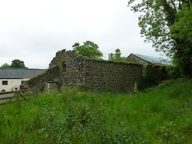
Image: © Mike Simms Taken: 27 May 2017
Dungonnell Mill, at the junction between the Ballyarnot Road and Antrim Road. No machinery remains, but the roofless building in the centre housed the corn mill. The building to the right of it housed the waterwheel and a possible scutch mill. The bank on the far right is part of the dam for the mill pond. Nearby there are two french burr stones, both of which are runners, suggesting that the mill had a least two stones.
Images are licensed for reuse under creativecommons.org/licenses/by-sa/2.0
Image Location
Latitude
54.677525
Longitude
-6.222133