Caergwrle Methodist Church
Introduction
The photograph on this page of Caergwrle Methodist Church by John S Turner as part of the Geograph project.
The Geograph project started in 2005 with the aim of publishing, organising and preserving representative images for every square kilometre of Great Britain, Ireland and the Isle of Man.

There are currently over 7.5m images from over 14,400 individuals and you can help contribute to the project by visiting https://www.geograph.org.uk
Caergwrle Methodist Church
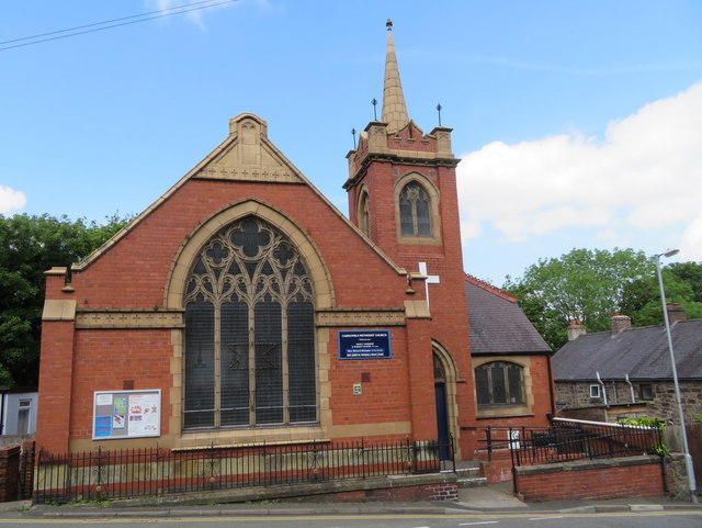
Image: © John S Turner Taken: 24 May 2017
Looking across Castle Street towards Caergwrle Methodist Church. There is half a bench mark on the low wall near the lamppost - Image The church stands on a downhill corner, and the scrape marks on the wall suggest that the wall is hit and rebuilt from time to time.
Images are licensed for reuse under creativecommons.org/licenses/by-sa/2.0
Image Location


Leaflet Map data © OpenStreetMap
Latitude
53.109726
Longitude
-3.035646