Stewarton from the air
Introduction
The photograph on this page of Stewarton from the air by Thomas Nugent as part of the Geograph project.
The Geograph project started in 2005 with the aim of publishing, organising and preserving representative images for every square kilometre of Great Britain, Ireland and the Isle of Man.

There are currently over 7.5m images from over 14,400 individuals and you can help contribute to the project by visiting https://www.geograph.org.uk
Stewarton from the air
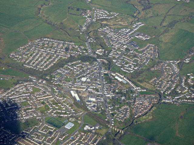
Image: © Thomas Nugent Taken: 17 Apr 2017
Stewarton dates back to the 12thC https://en.wikipedia.org/wiki/Stewarton and has a population of around 6500. It is served by Stewarton railway station which is to the left of the large buildings in the foreground. The Category B Listed Annick Water railway viaduct http://portal.historicenvironment.scot/designation/LB41074 can also be seen in the foreground.
Images are licensed for reuse under creativecommons.org/licenses/by-sa/2.0
Image Location
Latitude
55.677849
Longitude
-4.521917