Madeley Wood workhouse 'Brockholes' on Belmont Road
Introduction
The photograph on this page of Madeley Wood workhouse 'Brockholes' on Belmont Road by Richard Law as part of the Geograph project.
The Geograph project started in 2005 with the aim of publishing, organising and preserving representative images for every square kilometre of Great Britain, Ireland and the Isle of Man.

There are currently over 7.5m images from over 14,400 individuals and you can help contribute to the project by visiting https://www.geograph.org.uk
Madeley Wood workhouse 'Brockholes' on Belmont Road
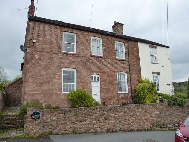
Image: © Richard Law Taken: 17 Apr 2017
Originally built in 1796 by the Madeley Parish board, to house 40 poor inmates. It operated as such until the 1870s, whereupon a much larger institution was built half a mile to the northwest at what is now the Beeches nursing home. Upon closure, this place was converted to residential use, although the black plaque suggests it may have served as a brewer's malthouse at one stage. That plaque also records that one of the unfortunate miners killed in the 1864 disaster at the nearby Madeley Wood ironstone mine lived nearby http://www.ninemen.org/the-project/the-background-to-the-nine-men-of-madeley-project/
Images are licensed for reuse under creativecommons.org/licenses/by-sa/2.0
Image Location
Latitude
52.629006
Longitude
-2.479081