RAF Leeming from the air
Introduction
The photograph on this page of RAF Leeming from the air by Thomas Nugent as part of the Geograph project.
The Geograph project started in 2005 with the aim of publishing, organising and preserving representative images for every square kilometre of Great Britain, Ireland and the Isle of Man.

There are currently over 7.5m images from over 14,400 individuals and you can help contribute to the project by visiting https://www.geograph.org.uk
RAF Leeming from the air
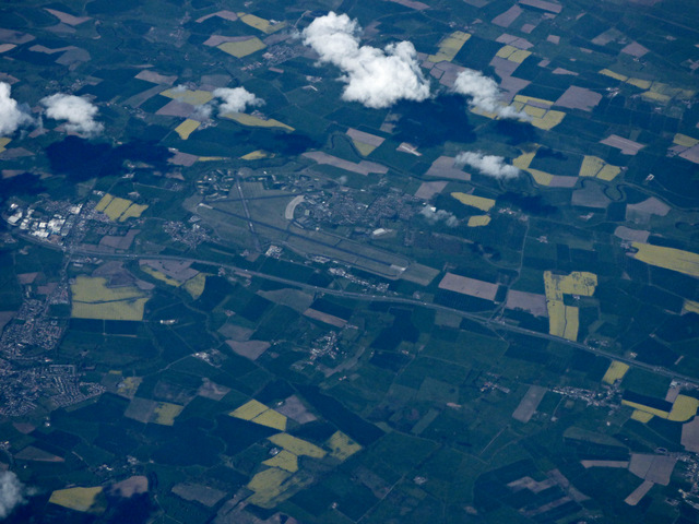
Image: © Thomas Nugent Taken: 1 May 2017
By the A1(M) at Londonderry. This is one of four RAF airfields within ten miles of each other, the others being the current RAF Topcliffe, the former RAF Skipton-on-Swale and the former RAF Dalton. Wikipedia Links... Skipton: https://en.wikipedia.org/wiki/RAF_Skipton-on-Swale Topcliffe: https://en.wikipedia.org/wiki/RAF_Topcliffe Dalton: https://en.wikipedia.org/wiki/RAF_Dalton Leeming: https://en.wikipedia.org/wiki/RAF_Leeming
Images are licensed for reuse under creativecommons.org/licenses/by-sa/2.0
Image Location
Latitude
54.29122
Longitude
-1.532941