The Old Vicarage, Steventon
Introduction
The photograph on this page of The Old Vicarage, Steventon by Chris Brown as part of the Geograph project.
The Geograph project started in 2005 with the aim of publishing, organising and preserving representative images for every square kilometre of Great Britain, Ireland and the Isle of Man.

There are currently over 7.5m images from over 14,400 individuals and you can help contribute to the project by visiting https://www.geograph.org.uk
The Old Vicarage, Steventon
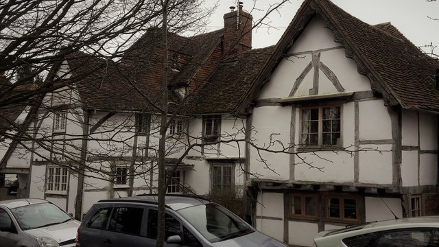
Image: © Chris Brown Taken: 19 Feb 2017
Seen from the elevated Causeway path. The west wing (right) is probably 14th century, the rest 16th.
Images are licensed for reuse under creativecommons.org/licenses/by-sa/2.0
Image Location


Leaflet Map data © OpenStreetMap
Latitude
51.622279
Longitude
-1.32653