Netheravon House: the stable block
Introduction
The photograph on this page of Netheravon House: the stable block by Stefan Czapski as part of the Geograph project.
The Geograph project started in 2005 with the aim of publishing, organising and preserving representative images for every square kilometre of Great Britain, Ireland and the Isle of Man.

There are currently over 7.5m images from over 14,400 individuals and you can help contribute to the project by visiting https://www.geograph.org.uk
Netheravon House: the stable block
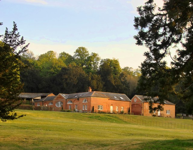
Image: © Stefan Czapski Taken: 10 May 2017
Zoom shot taken from the churchyard. The stables seem very grand in scale, given the size of the house itself. They are ranged around a large quadrangle, with the entrance on the north side (sunlit in this picture). The east side (shaded in the picture) faces the house, and is a formal composition arranged around a singular and extravagant architectural feature http://www.geograph.org.uk/photo/5391077 - plainly not intended for the benefit of the horses. It seems very odd that all inspiration (it can't surely have been a question of funds?) ran out when it came to the north-facing entrance - not blessed with as much as an arch. (Is there a grand entrance on the south side, perhaps? I rather suspect so). The Wiltshire volume of Pevsner dates the house to the late 18th century. When the Army's Cavalry School relocated to Netheravon in the early 1900s, the house became the officers' mess. I can't help wondering whether the availability of such sumptuous stable accommodation influenced the decision to move. Current use of the stable block appears to be residential.
Images are licensed for reuse under creativecommons.org/licenses/by-sa/2.0
Image Location
Latitude
51.233968
Longitude
-1.790979