Warburton Bridge, Manchester Ship Canal
Introduction
The photograph on this page of Warburton Bridge, Manchester Ship Canal by S Parish as part of the Geograph project.
The Geograph project started in 2005 with the aim of publishing, organising and preserving representative images for every square kilometre of Great Britain, Ireland and the Isle of Man.

There are currently over 7.5m images from over 14,400 individuals and you can help contribute to the project by visiting https://www.geograph.org.uk
Warburton Bridge, Manchester Ship Canal
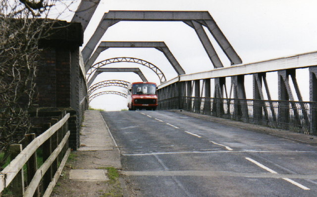
Image: © S Parish Taken: Unknown
Toll bridge over the Manchester Ship Canal. This picture was taken during a Government-funded scheme to provide rural bus services. Warrington Borough Transport briefly ran a 35 route from Culcheth to Warburton, possibly the only bus route ever over the bridge.
Images are licensed for reuse under creativecommons.org/licenses/by-sa/2.0
Image Location


Leaflet Map data © OpenStreetMap
Latitude
53.40755
Longitude
-2.459358