View from the edge of Big Wood
Introduction
The photograph on this page of View from the edge of Big Wood by Lairich Rig as part of the Geograph project.
The Geograph project started in 2005 with the aim of publishing, organising and preserving representative images for every square kilometre of Great Britain, Ireland and the Isle of Man.

There are currently over 7.5m images from over 14,400 individuals and you can help contribute to the project by visiting https://www.geograph.org.uk
View from the edge of Big Wood
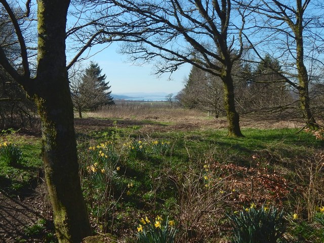
Image: © Lairich Rig Taken: 27 Mar 2017
The view is from the vicinity of the bench shown in Image Followed clockwise around Big Wood, the path, up to about this point, is beside a field, but here it is near a part of the golf course of Erskine Golf Club. What can be seen, in increasing order of distance, is: the edge of Big Wood, a part of the golf course, and the Firth of Clyde near the mouth of the Holy Loch. The dip at the right-hand side of the visible part of the skyline that can be seen in the gap, in this picture, is located there. A small bare tree stands in front of that dip. The New Statistical Account (1845), in its description of Erskine Parish, says that the chain of hills around the Holy Loch was, when viewed from the Bishopton area, known by a local name, "the Farrel of Cakes"(*), on account of the peculiar shape of those hills. [(*) That probably needs some explaining for modern readers. "Farrel" is a variant of the more usual "Farl", a word that referred to a quarter slice of a bannock (or of a scone, or shortbread, or similar items); expressions like "a farl o' cakes" or "a farl o' scones" were then in common use. The general idea of the old place-name is (I suppose) that the hills project towards one another in a way that reminded people of slices of cake arranged in a group.]
Images are licensed for reuse under creativecommons.org/licenses/by-sa/2.0
Image Location
Latitude
55.920441
Longitude
-4.490917