St Mary & St Peter's Wennington
Introduction
The photograph on this page of St Mary & St Peter's Wennington by Glyn Baker as part of the Geograph project.
The Geograph project started in 2005 with the aim of publishing, organising and preserving representative images for every square kilometre of Great Britain, Ireland and the Isle of Man.

There are currently over 7.5m images from over 14,400 individuals and you can help contribute to the project by visiting https://www.geograph.org.uk
St Mary & St Peter's Wennington
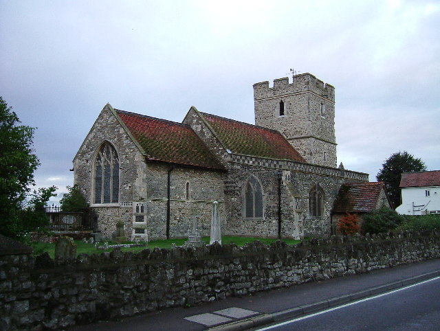
Image: © Glyn Baker Taken: 16 Sep 2005
The first Wennington Church is mentioned in the Domesday Book. Much of the current building dates from the 13th Century, the porch is a 19th Century addition. Less than twenty years ago the church was threatened with redundancy and was falling into disrepair. Grants from English Heritage and work by the “friends of Wennington Church” have saved the building.
Images are licensed for reuse under creativecommons.org/licenses/by-sa/2.0
Image Location
Latitude
51.50608
Longitude
0.216134