Ladywell
Introduction
The photograph on this page of Ladywell by Anne Burgess as part of the Geograph project.
The Geograph project started in 2005 with the aim of publishing, organising and preserving representative images for every square kilometre of Great Britain, Ireland and the Isle of Man.

There are currently over 7.5m images from over 14,400 individuals and you can help contribute to the project by visiting https://www.geograph.org.uk
Ladywell
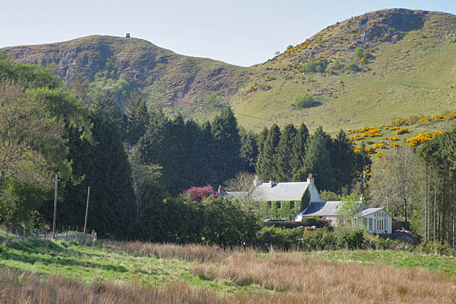
Image: © Anne Burgess Taken: 8 May 2017
The ivy-covered traditional-style house at Ladywell is in a sheltered hollow below the lava crags of the Sidlaw Hills.
Images are licensed for reuse under creativecommons.org/licenses/by-sa/2.0
Image Location
Latitude
56.434325
Longitude
-3.281389