Croydon Tramlink under construction at site of Mitcham station, 1998
Introduction
The photograph on this page of Croydon Tramlink under construction at site of Mitcham station, 1998 by Ben Brooksbank as part of the Geograph project.
The Geograph project started in 2005 with the aim of publishing, organising and preserving representative images for every square kilometre of Great Britain, Ireland and the Isle of Man.

There are currently over 7.5m images from over 14,400 individuals and you can help contribute to the project by visiting https://www.geograph.org.uk
Croydon Tramlink under construction at site of Mitcham station, 1998
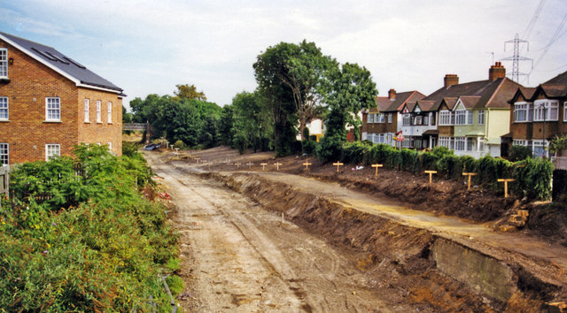
Image: © Ben Brooksbank Taken: 30 Aug 1998
View east from the London Road (A217) bridge. Formerly on the ex-LB&SCR West Croydon - Wimbledon branch, the station and line were closed 31/5/97 and reopened on the Wimbledon branch of the revolutionary new Croydon Tramlink on 30/5/00: see Image The houses on the right line Tramway Avenue, named from the ancient Surrey Iron Railway of 1801.
Images are licensed for reuse under creativecommons.org/licenses/by-sa/2.0
Image Location


Leaflet Map data © OpenStreetMap
Latitude
51.397667
Longitude
-0.171943