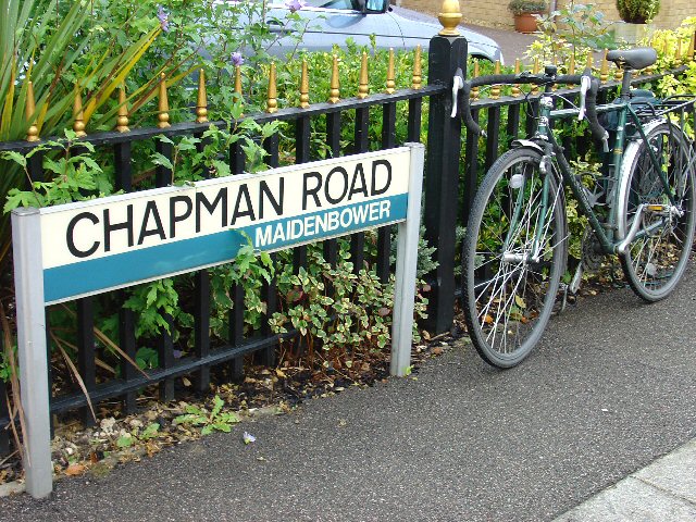
Chapman Road, Maidenbower - general pattern of street name signs in Crawley.
Introduction
The photograph on this page of Chapman Road, Maidenbower - general pattern of street name signs in Crawley. by Pete Chapman as part of the Geograph project.
The Geograph project started in 2005 with the aim of publishing, organising and preserving representative images for every square kilometre of Great Britain, Ireland and the Isle of Man.
There are currently over 7.5m images from over 14,400 individuals and you can help contribute to the project by visiting https://www.geograph.org.uk

Image: © Pete Chapman Taken: 15 Sep 2005
Sign for Chapman Road, next to Chapman's bike! The "neighbourhood" identity of the various parts of Crawley is emphasised by all of the street name signs having the name of the neighbourhood included on the bottom right corner of the sign (as shown in the picture). Additionally, each neighbourhood has its own colour for the band across the centre of the sign, Maidenbower uses a blue colour. Other area colours include: Northgate (green); Manor Royal Industrial Estate (Black - "Industrial").

