Flush bracket
Introduction
The photograph on this page of Flush bracket by Michael Rye as part of the Geograph project.
The Geograph project started in 2005 with the aim of publishing, organising and preserving representative images for every square kilometre of Great Britain, Ireland and the Isle of Man.

There are currently over 7.5m images from over 14,400 individuals and you can help contribute to the project by visiting https://www.geograph.org.uk
Flush bracket
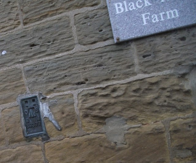
Image: © Michael Rye Taken: 7 May 2017
Flush bracket used by Ordnance survey. This flush bracket was used during the Third geodetic levelling, England & Wales. It was included on the Northallerton to Mickleby levelling line.
Images are licensed for reuse under creativecommons.org/licenses/by-sa/2.0
Image Location
Latitude
54.412437
Longitude
-1.27394