Hunsworth Lane, East Bierley, Hunsworth.
Introduction
The photograph on this page of Hunsworth Lane, East Bierley, Hunsworth. by Humphrey Bolton as part of the Geograph project.
The Geograph project started in 2005 with the aim of publishing, organising and preserving representative images for every square kilometre of Great Britain, Ireland and the Isle of Man.

There are currently over 7.5m images from over 14,400 individuals and you can help contribute to the project by visiting https://www.geograph.org.uk
Hunsworth Lane, East Bierley, Hunsworth.
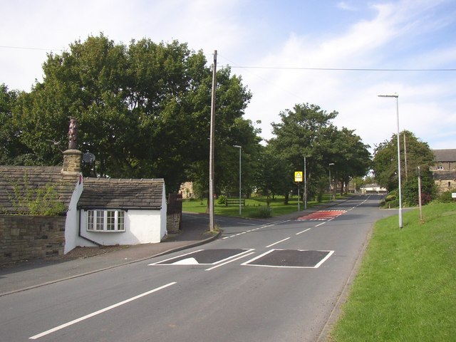
Image: © Humphrey Bolton Taken: 23 Aug 2007
On the left, the level of the cottage suggests that the road has been built up at some time, probably when it was widened, which is likely to have been in the late 19C or early 20C whilst Hunsworth had an Urban District Council. The triangular green in the centre contains the stocks. Part of the Methodist Chapel can be seen on the right.
Images are licensed for reuse under creativecommons.org/licenses/by-sa/2.0
Image Location
Latitude
53.757891
Longitude
-1.702683