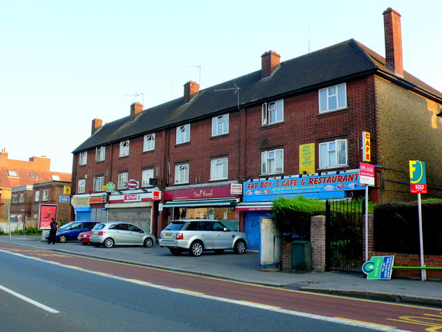
Row of Houses on Cambridge Rd the A2043
Introduction
The photograph on this page of Row of Houses on Cambridge Rd the A2043 by Nigel Mykura as part of the Geograph project.
The Geograph project started in 2005 with the aim of publishing, organising and preserving representative images for every square kilometre of Great Britain, Ireland and the Isle of Man.
There are currently over 7.5m images from over 14,400 individuals and you can help contribute to the project by visiting https://www.geograph.org.uk

Image: © Nigel Mykura Taken: 21 Jul 2013
There are five shops on the ground floor of this apartment block with the upper two stories being residential. The shops are from the left, Cambridge Fish Bar, Milano Barbers ( existing in 2016, but when this photo was taken the property was unoccupied), then a SPAR convenience store and then Daal Handi an Idian Restaurant and lastly Fatboys Cafe and Restaurant. Although by July 2016 three years after this photo was taken Fat Boys Cafe and Restaurant had taken over Daal Handi and the Indian restaurant had disappeared.

