Glasgow city centre from the air
Introduction
The photograph on this page of Glasgow city centre from the air by Thomas Nugent as part of the Geograph project.
The Geograph project started in 2005 with the aim of publishing, organising and preserving representative images for every square kilometre of Great Britain, Ireland and the Isle of Man.

There are currently over 7.5m images from over 14,400 individuals and you can help contribute to the project by visiting https://www.geograph.org.uk
Glasgow city centre from the air
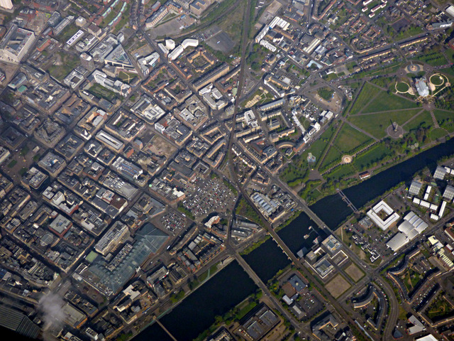
Image: © Thomas Nugent Taken: 1 May 2017
Central station is in the lower left corner, with the St Enoch shopping centre to its right. These are two of the largest glass roofs in the world. Glasgow Cross is near the centre of the photo with Glasgow Green to the top right. From the bottom of the screen, the bridges over the Clyde are the Suspension Bridge (Carlton Place), Victoria Bridge, City Union Railway bridge, Albert Bridge and the tidal weir.
Images are licensed for reuse under creativecommons.org/licenses/by-sa/2.0
Image Location
Latitude
55.854234
Longitude
-4.256268