Springburn from the air
Introduction
The photograph on this page of Springburn from the air by Thomas Nugent as part of the Geograph project.
The Geograph project started in 2005 with the aim of publishing, organising and preserving representative images for every square kilometre of Great Britain, Ireland and the Isle of Man.

There are currently over 7.5m images from over 14,400 individuals and you can help contribute to the project by visiting https://www.geograph.org.uk
Springburn from the air
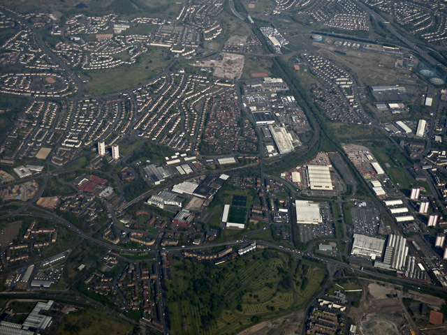
Image: © Thomas Nugent Taken: 1 May 2017
Sighthill Cemetery is in the foreground, with Costco and Tesco on the other side of Springburn Road. Petershill Park football ground is to the left of centre, Provan gas works, the M8 and M80 are to the top right.
Images are licensed for reuse under creativecommons.org/licenses/by-sa/2.0
Image Location
Latitude
55.878
Longitude
-4.239421