The moat at Chequer Court
Introduction
The photograph on this page of The moat at Chequer Court by John Baker as part of the Geograph project.
The Geograph project started in 2005 with the aim of publishing, organising and preserving representative images for every square kilometre of Great Britain, Ireland and the Isle of Man.

There are currently over 7.5m images from over 14,400 individuals and you can help contribute to the project by visiting https://www.geograph.org.uk
The moat at Chequer Court
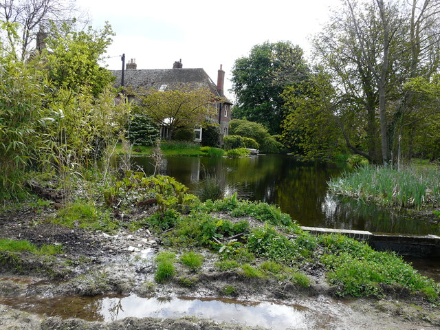
Image: © John Baker Taken: 16 Apr 2017
It is a grade II listed house, which dates from the 16th century. It was refaced in the 17th century and extended in the 19th and late 20th centuries http://www.britishlistedbuildings.co.uk/101070215-chequer-court-ash#.WQYxMP6GPcc I had chosen to walk along the edge of a field (and therefore was rewarded with this picturesque view), because the footpath had not been marked out across ridges, created for sowing potatoes, and this would have made the going hard work.
Images are licensed for reuse under creativecommons.org/licenses/by-sa/2.0
Image Location
Latitude
51.284856
Longitude
1.270816