Ruined Chapel, Tonyrefail
Introduction
The photograph on this page of Ruined Chapel, Tonyrefail by Chris Andrews as part of the Geograph project.
The Geograph project started in 2005 with the aim of publishing, organising and preserving representative images for every square kilometre of Great Britain, Ireland and the Isle of Man.

There are currently over 7.5m images from over 14,400 individuals and you can help contribute to the project by visiting https://www.geograph.org.uk
Ruined Chapel, Tonyrefail
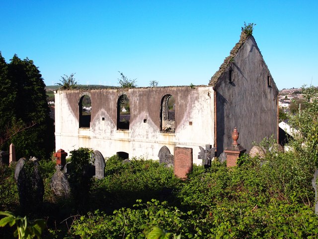
Image: © Chris Andrews Taken: 26 Apr 2017
Capel-y-Ton Calvinistic Methodist Chapel was originally built in 1788, rebuilt in 1863 and rebuilt again in 1905. It was destroyed by arson in 2007.
Images are licensed for reuse under creativecommons.org/licenses/by-sa/2.0
Image Location
Latitude
51.58403
Longitude
-3.429546