Brooke Church
Introduction
The photograph on this page of Brooke Church by Stephen McKay as part of the Geograph project.
The Geograph project started in 2005 with the aim of publishing, organising and preserving representative images for every square kilometre of Great Britain, Ireland and the Isle of Man.

There are currently over 7.5m images from over 14,400 individuals and you can help contribute to the project by visiting https://www.geograph.org.uk
Brooke Church
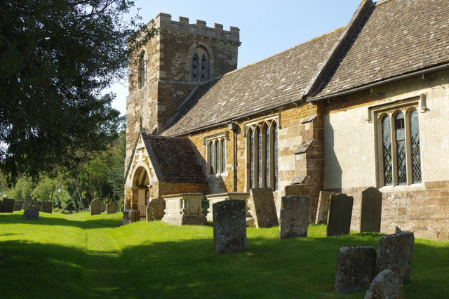
Image: © Stephen McKay Taken: 23 Apr 2017
The tower of St Peter's Church is 13th century although the crenellated top was added later. The rest of the church, however, was extensively rebuilt in Elizabethan times - an era when church building was a rarity. It is believed that this came about because Sir Andrew Noel, who acquired the former monastic property in Brooke, decided to restore the village church at the same time as he was building Brooke House.
Images are licensed for reuse under creativecommons.org/licenses/by-sa/2.0
Image Location
Latitude
52.642488
Longitude
-0.745671