Chapel Lane, Barton-upon-Humber, Lincolnshire
Introduction
The photograph on this page of Chapel Lane, Barton-upon-Humber, Lincolnshire by Bernard Sharp as part of the Geograph project.
The Geograph project started in 2005 with the aim of publishing, organising and preserving representative images for every square kilometre of Great Britain, Ireland and the Isle of Man.

There are currently over 7.5m images from over 14,400 individuals and you can help contribute to the project by visiting https://www.geograph.org.uk
Chapel Lane, Barton-upon-Humber, Lincolnshire
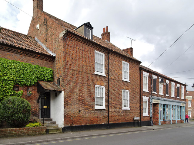
Image: © Bernard Sharp Taken: 20 Apr 2017
From left: No.3 Chapel Lane, house, 18th century. Grade II Listed Building https://www.historicengland.org.uk/listing/the-list/list-entry/1051615 Nos.5 & 7 Chapel Lane, house, late 18th or early 19th century, now with modern shop front. Grade II Listed Building https://www.historicengland.org.uk/listing/the-list/list-entry/1083114
Images are licensed for reuse under creativecommons.org/licenses/by-sa/2.0
Image Location
Latitude
53.684955
Longitude
-0.442947