Brigg Road, Barton-upon-Humber, Lincolnshire
Introduction
The photograph on this page of Brigg Road, Barton-upon-Humber, Lincolnshire by Bernard Sharp as part of the Geograph project.
The Geograph project started in 2005 with the aim of publishing, organising and preserving representative images for every square kilometre of Great Britain, Ireland and the Isle of Man.

There are currently over 7.5m images from over 14,400 individuals and you can help contribute to the project by visiting https://www.geograph.org.uk
Brigg Road, Barton-upon-Humber, Lincolnshire
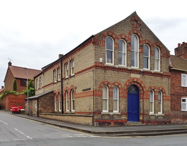
Image: © Bernard Sharp Taken: 20 Apr 2017
The foundation stone of the second and present Freemason's Lodge in the town at the junction with Castledyke South was laid 19 May 1875, and the new building was dedicated on 27 October 1875. Above the entrance door is a stone inscribed 'St Matthew Lodge No.1447'. 'A Short History of Freemasonry in Barton-upon-Humber': http://inbarton.atwebpages.com/novbt09.htm
Images are licensed for reuse under creativecommons.org/licenses/by-sa/2.0
Image Location


Leaflet Map data © OpenStreetMap
Latitude
53.682496
Longitude
-0.440463