Oil pipeline markers, Marsh Lane, Fobbing
Introduction
The photograph on this page of Oil pipeline markers, Marsh Lane, Fobbing by Robin Webster as part of the Geograph project.
The Geograph project started in 2005 with the aim of publishing, organising and preserving representative images for every square kilometre of Great Britain, Ireland and the Isle of Man.

There are currently over 7.5m images from over 14,400 individuals and you can help contribute to the project by visiting https://www.geograph.org.uk
Oil pipeline markers, Marsh Lane, Fobbing
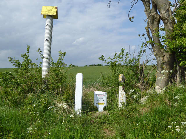
Image: © Robin Webster Taken: 23 Apr 2017
A former GPSS pipeline, now privatised. The plate indicates a Thames Haven - Saffron Walden route for a 10" bore pipe. This was installed during WWII to serve East Anglian airfields via branching spurs. The two shorter posts are the remains (lacking crossbars) of the original GPSS 'pseudo stile' marker. One is intact on the other side of the lane.
Images are licensed for reuse under creativecommons.org/licenses/by-sa/2.0
Image Location


Leaflet Map data © OpenStreetMap
Latitude
51.534376
Longitude
0.478361