Old Milestone by the A4010, Saunderton
Introduction
The photograph on this page of Old Milestone by the A4010, Saunderton by A Rosevear & J Higgins as part of the Geograph project.
The Geograph project started in 2005 with the aim of publishing, organising and preserving representative images for every square kilometre of Great Britain, Ireland and the Isle of Man.

There are currently over 7.5m images from over 14,400 individuals and you can help contribute to the project by visiting https://www.geograph.org.uk
Old Milestone by the A4010, Saunderton
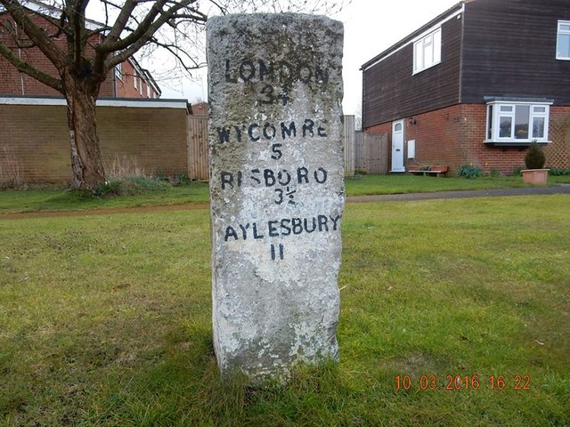
Image: © A Rosevear & J Higgins Taken: 3 Sep 2002
Carved stone post by the A4010, in parish of BLEDLOW CUM SAUNDERTON (WYCOMBE District), Chiltern View; houses near Saunderton, at junction with Hill View, on well cut grass verge between footpath and cycle path, on West side of road. Wycombe stone post, erected by the Ellesborough to West Wycombe turnpike trust in the 19th century. Inscription reads:- LONDON 34 WYCOMBE 5 RISBORO 3½ AYLESBURY 11 Cut benchmark very low on East face. Milestone Society National ID: BU_WYAY05
Images are licensed for reuse under creativecommons.org/licenses/by-sa/2.0
Image Location


Leaflet Map data © OpenStreetMap
Latitude
51.678197
Longitude
-0.825727