Replacement Milestone by the A5, Watling Street, south east of Little Brickhill
Introduction
The photograph on this page of Replacement Milestone by the A5, Watling Street, south east of Little Brickhill by A Rosevear as part of the Geograph project.
The Geograph project started in 2005 with the aim of publishing, organising and preserving representative images for every square kilometre of Great Britain, Ireland and the Isle of Man.

There are currently over 7.5m images from over 14,400 individuals and you can help contribute to the project by visiting https://www.geograph.org.uk
Replacement Milestone by the A5, Watling Street, south east of Little Brickhill
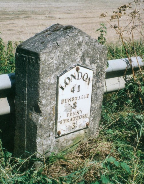
Image: © A Rosevear Taken: 19 Jul 2003
Metal plate attached to concrete post by the A5, in parish of LITTLE BRICKHILL (MILTON KEYNES District), Main Road; 50m North West of lane to Rammamere Farm and half mile North West of County Boundary, South East of Little Brickhill turn, on the verge between road and crash barrier, on East side of road. Milton Keynes iron plate on concrete, erected by the Holyhead Road (Hockliffe Div) turnpike trust in the 20th century. Inscription reads:- LONDON 41 DUNSTABLE 8 FENNY STRATFORD 3 Milestone Society National ID: BU_LH41R
Images are licensed for reuse under creativecommons.org/licenses/by-sa/2.0
Image Location
Latitude
51.971612
Longitude
-0.657342