Old Milestone by the A422, Brackley Road, east of Westbury
Introduction
The photograph on this page of Old Milestone by the A422, Brackley Road, east of Westbury by Alan Rosevear as part of the Geograph project.
The Geograph project started in 2005 with the aim of publishing, organising and preserving representative images for every square kilometre of Great Britain, Ireland and the Isle of Man.

There are currently over 7.5m images from over 14,400 individuals and you can help contribute to the project by visiting https://www.geograph.org.uk
Old Milestone by the A422, Brackley Road, east of Westbury
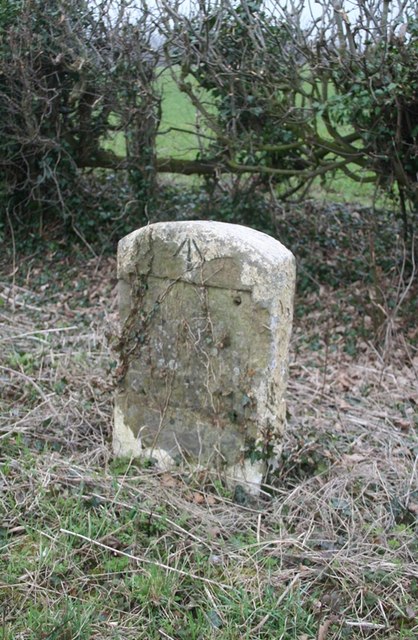
Image: © Alan Rosevear Taken: 3 Mar 2012
Stone post (plate lost) by the A422, in parish of WESTBURY (AYLESBURY VALE District), Brackley Road; half mile East of Westbury village, on wide verge between road and hedge, on South side of road. Brackley tombstone and iron plate, erected by the Buckingham, Brackley, Banbury turnpike trust in the 19th century. Inscription once read:- Buckingham 5 Brackley 3 Carved benchmark and rivet on top. Milestone Society National ID: BU_LCN61
Images are licensed for reuse under creativecommons.org/licenses/by-sa/2.0
Image Location
Latitude
52.019362
Longitude
-1.084959