Old Milestone by the A413, east of Little Missenden
Introduction
The photograph on this page of Old Milestone by the A413, east of Little Missenden by A Rosevear & J Higgins as part of the Geograph project.
The Geograph project started in 2005 with the aim of publishing, organising and preserving representative images for every square kilometre of Great Britain, Ireland and the Isle of Man.

There are currently over 7.5m images from over 14,400 individuals and you can help contribute to the project by visiting https://www.geograph.org.uk
Old Milestone by the A413, east of Little Missenden
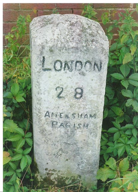
Image: © A Rosevear & J Higgins Taken: 20 Mar 2003
Carved stone post by the A413, in parish of LITTLE MISSENDEN (CHILTERN District), junction with Keepers Lane, by Pipers Wood Cottages, East of Lime Farm, in front of brick retaining wall, on North side of road. Amersham limestone square, erected by the Wendover & Oak Lane turnpike trust in the 18th century. Inscription reads:- LONDON 28 AMERSHAM PARISH Carved benchmark lower front face. Milestone Society National ID: BU_LC28
Images are licensed for reuse under creativecommons.org/licenses/by-sa/2.0
Image Location


Leaflet Map data © OpenStreetMap
Latitude
51.681328
Longitude
-0.655689