The Remains of Carn Brea Mine
Introduction
The photograph on this page of The Remains of Carn Brea Mine by Tony Atkin as part of the Geograph project.
The Geograph project started in 2005 with the aim of publishing, organising and preserving representative images for every square kilometre of Great Britain, Ireland and the Isle of Man.

There are currently over 7.5m images from over 14,400 individuals and you can help contribute to the project by visiting https://www.geograph.org.uk
The Remains of Carn Brea Mine
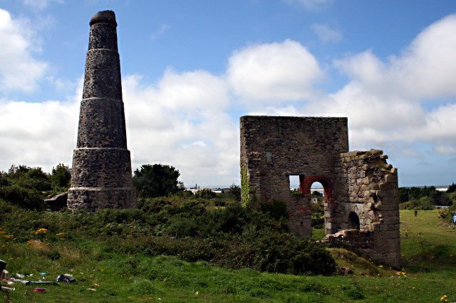
Image: © Tony Atkin Taken: 24 Aug 2007
Situated at the northern foot of Carn Brea hill, this mine was amalgamated with South Tincroft before becoming part of South Crofty.
Images are licensed for reuse under creativecommons.org/licenses/by-sa/2.0
Image Location
Latitude
50.222203
Longitude
-5.261065