Queen Street, Mexborough
Introduction
The photograph on this page of Queen Street, Mexborough by David Wilkinson as part of the Geograph project.
The Geograph project started in 2005 with the aim of publishing, organising and preserving representative images for every square kilometre of Great Britain, Ireland and the Isle of Man.

There are currently over 7.5m images from over 14,400 individuals and you can help contribute to the project by visiting https://www.geograph.org.uk
Queen Street, Mexborough
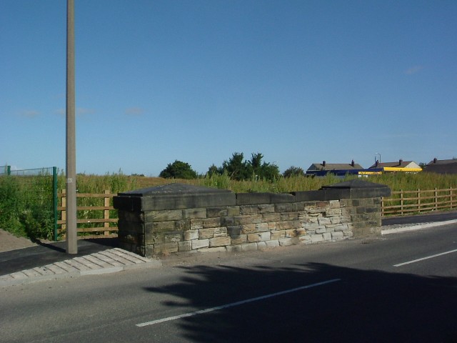
Image: © David Wilkinson Taken: 26 Aug 2007
What appears to be a short section of wall is actually part of a former railway bridge. The cutting on both sides of Queen Street has been landfilled up to and above the level of the road - witness the newly constructed tarmac footpath going behind the "wall". The former Wath Road landfill site, behind the wooden fence, that used the cutting is now closed and the site has been landscaped.
Images are licensed for reuse under creativecommons.org/licenses/by-sa/2.0
Image Location
Latitude
53.49586
Longitude
-1.306569