Postbox BT26 200, Moira Road, Hillsborough (April 2017)
Introduction
The photograph on this page of Postbox BT26 200, Moira Road, Hillsborough (April 2017) by Albert Bridge as part of the Geograph project.
The Geograph project started in 2005 with the aim of publishing, organising and preserving representative images for every square kilometre of Great Britain, Ireland and the Isle of Man.

There are currently over 7.5m images from over 14,400 individuals and you can help contribute to the project by visiting https://www.geograph.org.uk
Postbox BT26 200, Moira Road, Hillsborough (April 2017)
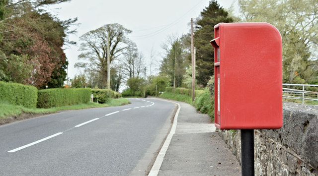
Image: © Albert Bridge Taken: 18 Apr 2017
A new postbox (BT26 200), on the Moira Road, close to the bypass. The bridge (lower right) formerly carried the road across the GNR(I) Knockmore Jct – Banbridge/Castlewellan railway. The cutting has been infilled to road level.
Images are licensed for reuse under creativecommons.org/licenses/by-sa/2.0
Image Location
Latitude
54.464822
Longitude
-6.095794