The Duke of Northumberland's River: Isleworth Mill Bridge
Introduction
The photograph on this page of The Duke of Northumberland's River: Isleworth Mill Bridge by Nigel Cox as part of the Geograph project.
The Geograph project started in 2005 with the aim of publishing, organising and preserving representative images for every square kilometre of Great Britain, Ireland and the Isle of Man.

There are currently over 7.5m images from over 14,400 individuals and you can help contribute to the project by visiting https://www.geograph.org.uk
The Duke of Northumberland's River: Isleworth Mill Bridge
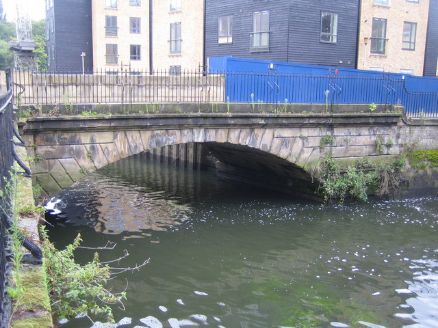
Image: © Nigel Cox Taken: 22 Aug 2007
The Mill Bridge was built to carry Church Street over The Duke of Northumberland's River. The river is an artificial cut dug in the 16th century to provide a water supply for Isleworth flour mill. The original Tudor mill building was destroyed by fire in 1795 and was replaced by a larger brick built structure. The mill closed in 1934, and was demolished, along with the granary, in 1941. The bridge, and the mill basin to the right in the photograph, are therefore the only surviving major artefacts of the previous industrial use of the site.
Images are licensed for reuse under creativecommons.org/licenses/by-sa/2.0
Image Location
Latitude
51.470062
Longitude
-0.32268