River, canal towpath & canal seen from Silverwoods Way, Kidderminster, Worcs
Introduction
The photograph on this page of River, canal towpath & canal seen from Silverwoods Way, Kidderminster, Worcs by P L Chadwick as part of the Geograph project.
The Geograph project started in 2005 with the aim of publishing, organising and preserving representative images for every square kilometre of Great Britain, Ireland and the Isle of Man.

There are currently over 7.5m images from over 14,400 individuals and you can help contribute to the project by visiting https://www.geograph.org.uk
River, canal towpath & canal seen from Silverwoods Way, Kidderminster, Worcs
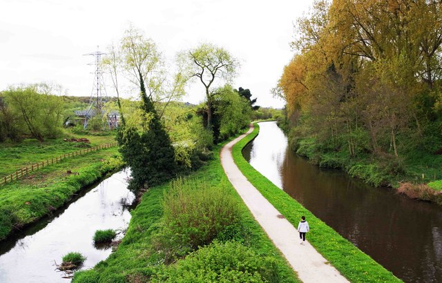
Image: © P L Chadwick Taken: 16 Apr 2017
Looking south from the new bridge carrying Silverwoods Way. On the left is the River Stour and on the right is the Staffordshire & Worcestershire Canal. The canal towpath is between them. In the distance, on the left, is an electricity pylon. Image
Images are licensed for reuse under creativecommons.org/licenses/by-sa/2.0
Image Location
Latitude
52.371246
Longitude
-2.252