The Duke of Northumberland's River in Isleworth
Introduction
The photograph on this page of The Duke of Northumberland's River in Isleworth by Nigel Cox as part of the Geograph project.
The Geograph project started in 2005 with the aim of publishing, organising and preserving representative images for every square kilometre of Great Britain, Ireland and the Isle of Man.

There are currently over 7.5m images from over 14,400 individuals and you can help contribute to the project by visiting https://www.geograph.org.uk
The Duke of Northumberland's River in Isleworth
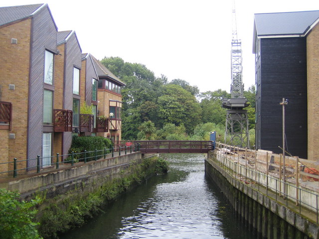
Image: © Nigel Cox Taken: 22 Aug 2007
Just past the footbridge is the point of confluence of The Duke of Northumberland's River with the River Thames, with the tree-covered island of Isleworth Ait beyond. The Duke of Northumberland's River is an artificial cut, built in the 16th century to provide water for the flour mill at Isleworth.
Images are licensed for reuse under creativecommons.org/licenses/by-sa/2.0
Image Location
Latitude
51.470062
Longitude
-0.32268