Bowling Street, Sandwich
Introduction
The photograph on this page of Bowling Street, Sandwich by Marathon as part of the Geograph project.
The Geograph project started in 2005 with the aim of publishing, organising and preserving representative images for every square kilometre of Great Britain, Ireland and the Isle of Man.

There are currently over 7.5m images from over 14,400 individuals and you can help contribute to the project by visiting https://www.geograph.org.uk
Bowling Street, Sandwich
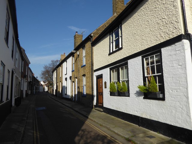
Image: © Marathon Taken: 28 Mar 2017
Sandwich is the most complete medieval town in England. The impression is of a French or Dutch town because of the Flemish protestant refugees who came over in the 16th and 17th centuries. It has an intricate street pattern. This is Bowling Street, close to the junction with Delf Street.
Images are licensed for reuse under creativecommons.org/licenses/by-sa/2.0
Image Location
Latitude
51.276117
Longitude
1.338172