Agricultural buildings, Holywell Farm, Holywell Lane
Introduction
The photograph on this page of Agricultural buildings, Holywell Farm, Holywell Lane by John Baker as part of the Geograph project.
The Geograph project started in 2005 with the aim of publishing, organising and preserving representative images for every square kilometre of Great Britain, Ireland and the Isle of Man.

There are currently over 7.5m images from over 14,400 individuals and you can help contribute to the project by visiting https://www.geograph.org.uk
Agricultural buildings, Holywell Farm, Holywell Lane
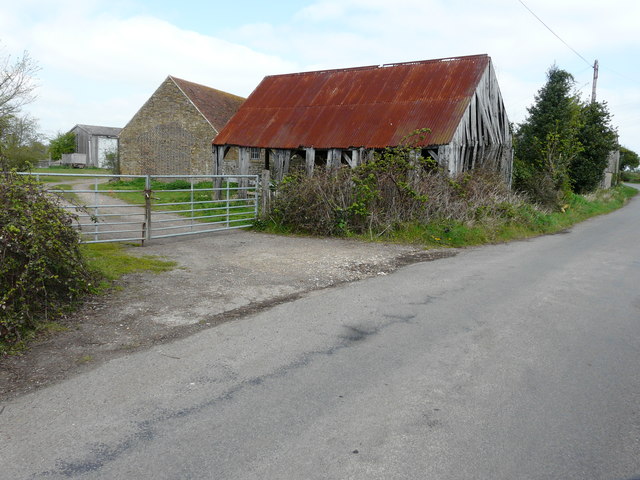
Image: © John Baker Taken: 2 Apr 2017
Swale Borough Council decided that prior notification was not required for planning application 16/507061/PNQCLA, the “prior notification for the change of use of two agricultural buildings to 2 residential dwellings and for associated operational development”. The buildings, mentioned in the application, are the one built of bricks and the building beyond it. It is possible that the ramshackle building, with a corrugate iron roof, may be demolished.
Images are licensed for reuse under creativecommons.org/licenses/by-sa/2.0
Image Location
Latitude
51.372096
Longitude
0.656528