Baste Walls, Totnes
Introduction
The photograph on this page of Baste Walls, Totnes by Derek Harper as part of the Geograph project.
The Geograph project started in 2005 with the aim of publishing, organising and preserving representative images for every square kilometre of Great Britain, Ireland and the Isle of Man.

There are currently over 7.5m images from over 14,400 individuals and you can help contribute to the project by visiting https://www.geograph.org.uk
Baste Walls, Totnes
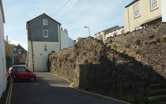
Image: © Derek Harper Taken: 11 Apr 2017
The Baste Walls are a "Late C14 southern circuit of the Totnes Town wall ... extensively repaired in circa 1639" https://www.historicengland.org.uk/listing/the-list/list-entry/1236962 . The upper and lower parts of South Street, linked here by a flight of steps, reunite further west. The house in between them, on the wall, is "Possibly [a] late C14 defensive tower" https://www.historicengland.org.uk/listing/the-list/list-entry/1264388 .
Images are licensed for reuse under creativecommons.org/licenses/by-sa/2.0
Image Location
Latitude
50.430731
Longitude
-3.689073