Ferniehurst recreation ground
Introduction
The photograph on this page of Ferniehurst recreation ground by Stephen Craven as part of the Geograph project.
The Geograph project started in 2005 with the aim of publishing, organising and preserving representative images for every square kilometre of Great Britain, Ireland and the Isle of Man.

There are currently over 7.5m images from over 14,400 individuals and you can help contribute to the project by visiting https://www.geograph.org.uk
Ferniehurst recreation ground
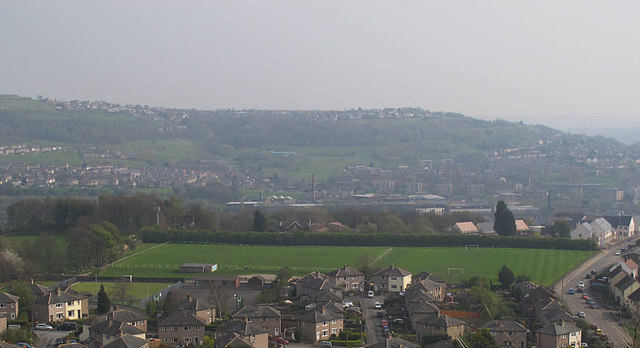
Image: © Stephen Craven Taken: 9 Apr 2017
This flat area above Baildon Wood and below Baildon Bank is an obvious site for sporting activities. Older maps show it as a "stud and training ground"; now it consists of football pitches, tennis courts and a bowling green. Viewed from the top of Baildon Bank.
Images are licensed for reuse under creativecommons.org/licenses/by-sa/2.0
Image Location
Latitude
53.843697
Longitude
-1.771533