Old Milepost by the B5139, Hoylake
Introduction
The photograph on this page of Old Milepost by the B5139, Hoylake by Milestone Society as part of the Geograph project.
The Geograph project started in 2005 with the aim of publishing, organising and preserving representative images for every square kilometre of Great Britain, Ireland and the Isle of Man.

There are currently over 7.5m images from over 14,400 individuals and you can help contribute to the project by visiting https://www.geograph.org.uk
Old Milepost by the B5139, Hoylake
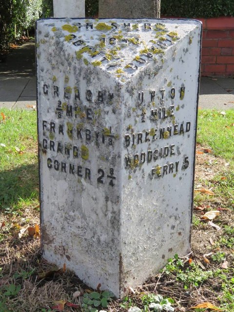
Image: © Milestone Society Taken: Unknown
Cast iron post by the B5139, in parish of HOYLAKE (WIRRAL District), East of Brookdale Ave junction, on the verge, on South East side of road. Cast iron CCC 1898, erected by Cheshire County Council in the 19th century. Inscription reads:- : GREASBY / ⅔ MILE / FRANKBY 1⅓ / GRANGE / CORNER 2¾ : : CHESHIRE / 1898 / COUNTY COUNCIL : : UPTON / ½ MILE / BIRKENHEAD / WOODSIDE / FERRY 5 : Maker:- : W H SMITH & CO / MAKER / WHITCHURCH : Milestone Society National ID: CH_BHGC05.
Images are licensed for reuse under creativecommons.org/licenses/by-sa/2.0
Image Location
Latitude
53.382237
Longitude
-3.110204