Old Milepost by the A35, Holmsley
Introduction
The photograph on this page of Old Milepost by the A35, Holmsley by Milestone Society as part of the Geograph project.
The Geograph project started in 2005 with the aim of publishing, organising and preserving representative images for every square kilometre of Great Britain, Ireland and the Isle of Man.

There are currently over 7.5m images from over 14,400 individuals and you can help contribute to the project by visiting https://www.geograph.org.uk
Old Milepost by the A35, Holmsley
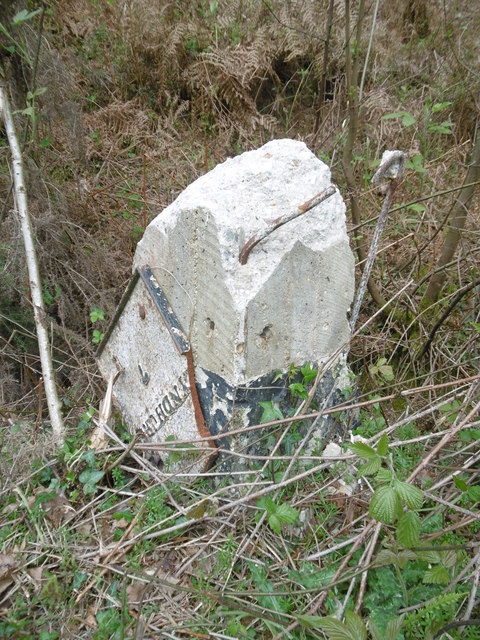
Image: © Milestone Society Taken: 13 Apr 2017
The remains of metal plates attached to concrete post by the A35, in parish of BURLEY (NEW FOREST District), Brownhill Enclosure; 300m North of Holmsley Toll house, by the road, on West side of road. Lyndhurst plate, erected by the Christchurch & Lyndhurst Turnpike Trust in the 19th century. The damage was caused by recent careless verge cutting. Inscription reads:- : LYNDHURST / 7 / (XT CHURCH / 7 / BOURNE / 12) : Milestone Society National ID: HA_LHCC07.
Images are licensed for reuse under creativecommons.org/licenses/by-sa/2.0
Image Location
Latitude
50.800716
Longitude
-1.673988