Rotherhope Fell Mine - Blackburn Level
Introduction
The photograph on this page of Rotherhope Fell Mine - Blackburn Level by John Gibson as part of the Geograph project.
The Geograph project started in 2005 with the aim of publishing, organising and preserving representative images for every square kilometre of Great Britain, Ireland and the Isle of Man.

There are currently over 7.5m images from over 14,400 individuals and you can help contribute to the project by visiting https://www.geograph.org.uk
Rotherhope Fell Mine - Blackburn Level
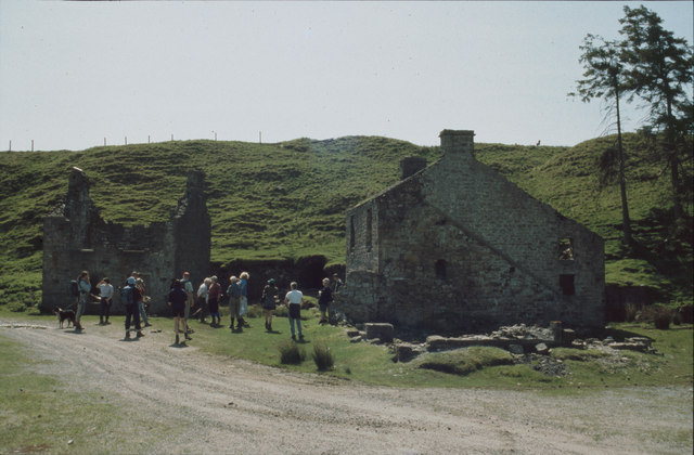
Image: © John Gibson Taken: Unknown
This is the entrance to what became the main access level to the Rotherhope (also Rodderup) Fell Mine. It was named after the Black Burn, which flows behind the photographer's position. The buildings either side of the stone-arched level portal include the blacksmith's shop, office and stores.
Images are licensed for reuse under creativecommons.org/licenses/by-sa/2.0
Image Location


Leaflet Map data © OpenStreetMap
Latitude
54.777763
Longitude
-2.469005