Blackpool Talbot Road / North railway station (site), Lancashire, 2017
Introduction
The photograph on this page of Blackpool Talbot Road / North railway station (site), Lancashire, 2017 by Nigel Thompson as part of the Geograph project.
The Geograph project started in 2005 with the aim of publishing, organising and preserving representative images for every square kilometre of Great Britain, Ireland and the Isle of Man.

There are currently over 7.5m images from over 14,400 individuals and you can help contribute to the project by visiting https://www.geograph.org.uk
Blackpool Talbot Road / North railway station (site), Lancashire, 2017
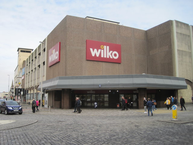
Image: © Nigel Thompson Taken: 12 Apr 2017
Opened in 1846 by the Preston & Wyre Joint Railway (joint between the Lancashire & Yorkshire Railway and the London & North Western Railway) as the terminus of the line from Preston. It was rebuilt in 1898, and renamed Blackpool North in 1953. It closed in 1974 and the site was redeveloped. View towards the former frontage on Dickson Street, once the site of a clock tower. When the station was rebuilt in 1898, a number of adjacent Excursion Platforms were added, a few blocks away. In 1974, these became the basis for the new Blackpool North station - see Image In 2020 the Wilko store was demolished to make room for an extension to the Blackpool tram system.
Images are licensed for reuse under creativecommons.org/licenses/by-sa/2.0
Image Location


Leaflet Map data © OpenStreetMap
Latitude
53.820522
Longitude
-3.051123