Castle Road and surroundings
Introduction
The photograph on this page of Castle Road and surroundings by Lairich Rig as part of the Geograph project.
The Geograph project started in 2005 with the aim of publishing, organising and preserving representative images for every square kilometre of Great Britain, Ireland and the Isle of Man.

There are currently over 7.5m images from over 14,400 individuals and you can help contribute to the project by visiting https://www.geograph.org.uk
Castle Road and surroundings
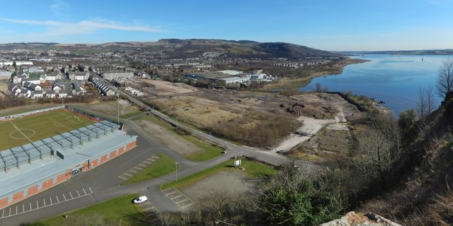
Image: © Lairich Rig Taken: 26 Mar 2017
This wide-angle view is intended to show developments around Castle Road. To its west (left) are the grounds of Image Behind the stadium is the recent housing that makes up the Castle Quay development: Image The other side (east) of the road was formerly the site of the Blackburn Aircraft Factory, later used by Allied Distillers: Image The factories shown there were later demolished. By the time the present picture was taken, a new housing development was beginning on that site: Image (see http://www.geograph.org.uk/snippet/15948 for related pictures). Further to the right is Image
Images are licensed for reuse under creativecommons.org/licenses/by-sa/2.0
Image Location
Latitude
55.937621
Longitude
-4.560398