Victoria Place, Newport
Introduction
The photograph on this page of Victoria Place, Newport by Chris Brown as part of the Geograph project.
The Geograph project started in 2005 with the aim of publishing, organising and preserving representative images for every square kilometre of Great Britain, Ireland and the Isle of Man.

There are currently over 7.5m images from over 14,400 individuals and you can help contribute to the project by visiting https://www.geograph.org.uk
Victoria Place, Newport
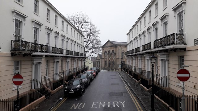
Image: © Chris Brown Taken: 6 Dec 2016
A formal early Victorian scheme off Stow Hill. It has been restored but the bases of some of the first floor balconies appear to be decaying. The former Victoria Road United Reformed church at the end now houses the Islamic Society for Wales.
Images are licensed for reuse under creativecommons.org/licenses/by-sa/2.0
Image Location
Latitude
51.584189
Longitude
-2.99669