Rear of former Oakdale Public House Oakdale
Introduction
The photograph on this page of Rear of former Oakdale Public House Oakdale by M J Roscoe as part of the Geograph project.
The Geograph project started in 2005 with the aim of publishing, organising and preserving representative images for every square kilometre of Great Britain, Ireland and the Isle of Man.

There are currently over 7.5m images from over 14,400 individuals and you can help contribute to the project by visiting https://www.geograph.org.uk
Rear of former Oakdale Public House Oakdale
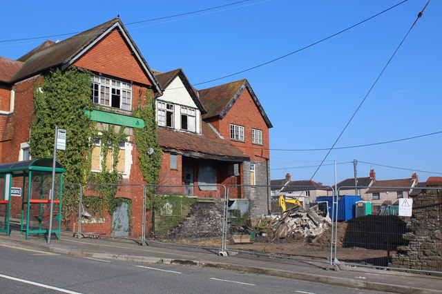
Image: © M J Roscoe Taken: 7 Apr 2017
Conversion of this grade II listed building Image to apartments is now underway. In addition a row of three terraced houses will be built in the yard immediately behind the security fence; the stone wall having been demolished for use elsewhere on the site.
Images are licensed for reuse under creativecommons.org/licenses/by-sa/2.0
Image Location
Latitude
51.678087
Longitude
-3.178383