WWII Hampshire: environs of Havant & Emsworth - Comley Hill area pillbox no. 1 (7)
Introduction
The photograph on this page of WWII Hampshire: environs of Havant & Emsworth - Comley Hill area pillbox no. 1 (7) by Mike Searle as part of the Geograph project.
The Geograph project started in 2005 with the aim of publishing, organising and preserving representative images for every square kilometre of Great Britain, Ireland and the Isle of Man.

There are currently over 7.5m images from over 14,400 individuals and you can help contribute to the project by visiting https://www.geograph.org.uk
WWII Hampshire: environs of Havant & Emsworth - Comley Hill area pillbox no. 1 (7)
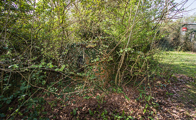
Image: © Mike Searle Taken: 7 Apr 2017
- Pillbox (unclassified): DoB ID: S0012777 Somewhat ambiguously this is also classified as a pillbox/section post, presumably because it does bear some resemblance to a small section post or blockhouse. It is not L-shaped as described on the national database, but rectangular, with three south facing embrasures, and an entrance in the centre on the north side with loopholes at each end facing east and west. It is located within private grounds that once overlooked open ground bounded by the railway, Prospect Lane, and the Emsworth - Horndean road. It is heavily overgrown. Image
Images are licensed for reuse under creativecommons.org/licenses/by-sa/2.0
Image Location
Latitude
50.875328
Longitude
-0.960561