
Betchets Green Road, Holmwood
Introduction
The photograph on this page of Betchets Green Road, Holmwood by Hugh Craddock as part of the Geograph project.
The Geograph project started in 2005 with the aim of publishing, organising and preserving representative images for every square kilometre of Great Britain, Ireland and the Isle of Man.

There are currently over 7.5m images from over 14,400 individuals and you can help contribute to the project by visiting https://www.geograph.org.uk
Betchets Green Road, Holmwood
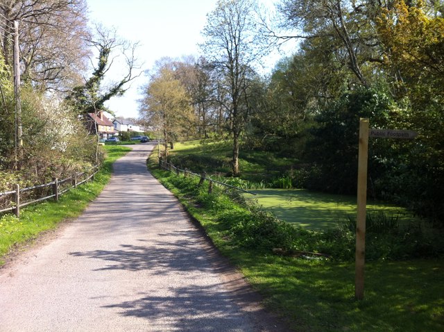
Image: © Hugh Craddock Taken: 7 Apr 2017
This stretch of Betchets Green Road appears to be a private road (beyond the junction with Buckingham Road at the top of the rise in the photo), and is classified only as a public footpath 264 Holmwood (footpath 266a leads off on the right to Holmwood Corner). However, the precise status is perhaps a bit academic for non-motorised users, as this is also part of Holmwood Common, the land is owned by the National Trust, and there are access rights to it for walkers and horse riders under section 193 of the Law of Property Act 1925.
Images are licensed for reuse under creativecommons.org/licenses/by-sa/2.0
Image Location

Latitude
51.190627
Longitude
-0.326405